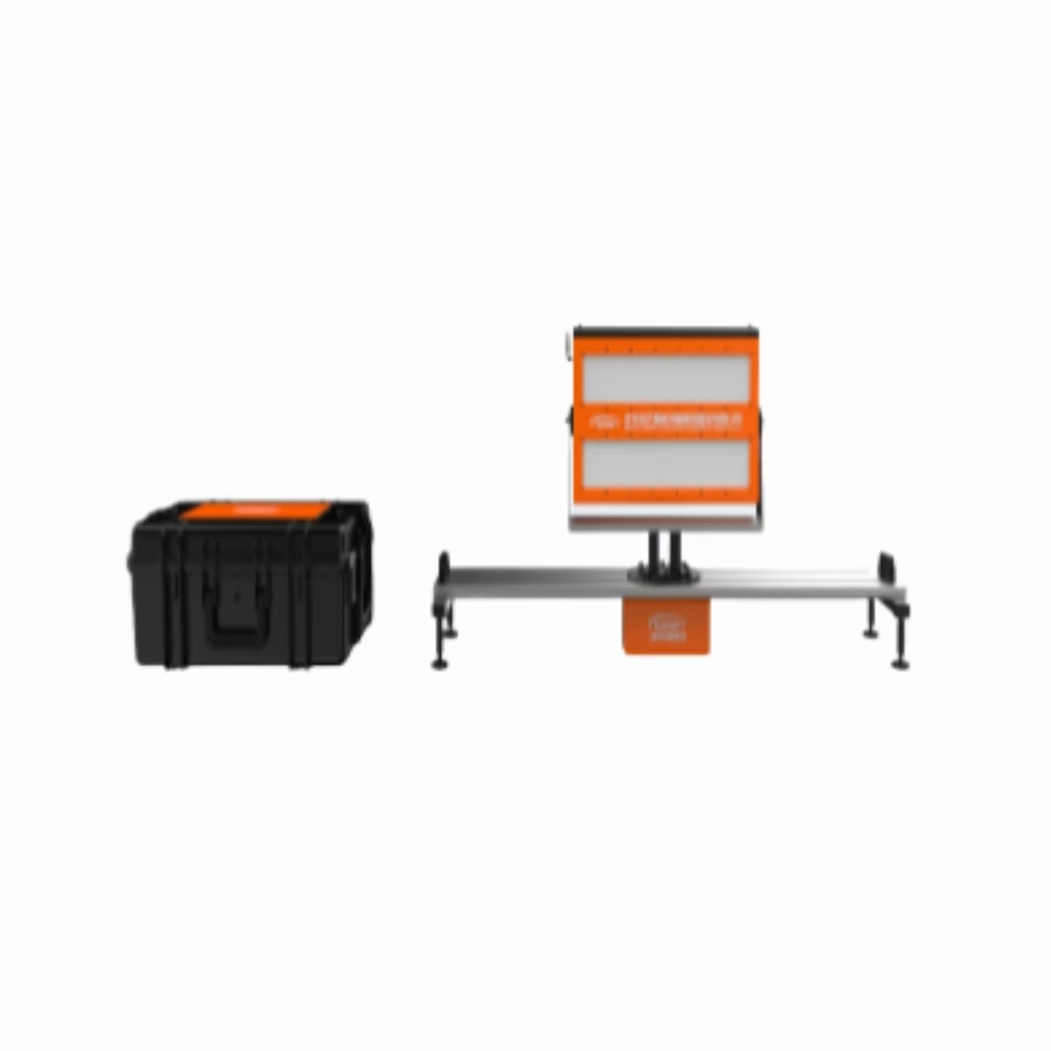
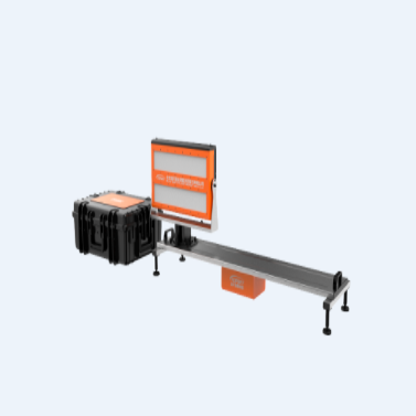
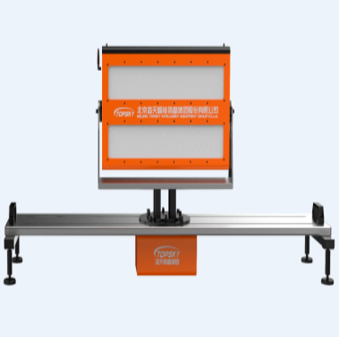
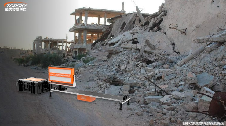
logo
हमसे संपर्क करें

व्यक्ति से संपर्क करें : Yang

फ़ोन नंबर : +8618010030825

WhatsApp : +8613436381865

Free call

Panoramic Slope Monitoring Radar with 120° Wide Coverage 0.1mm Deformation Accuracy and 8kg Lightweight for Emergency Rescue

उत्पत्ति के प्लेस: चीन ब्रांड नाम: topsky

विस्तार जानकारी

अधिकतम रैखिक गति: ≥1.52m/s, रिमोट कंट्रोल स्टेपलेस स्पीड तौलना: 15.5 किग्रा
खुला आकार: 1880 मिमी भंडारण तापमान: -45℃~65℃;
बॉडी वेट: 16 किलोग्राम नमी: 0-100%
संचालन विधा: : "ग्राउंड बैलेंस"/ "भेदभाव" कोण: 120degree
याद: 8 जी एस.डी. रस्सी का स्लिंग: 3/4/5 मिमी डिया*2m
उत्पाद काम कर रहा है एफ: 2.4GHz मूल्यांकित शक्ति: 7.5 किलोवाट
सीधी विचलन राशि: ≤0.7% दूरस्थ आकार: 278*184*43 मिमी
मापने की सीमा: 0-550mg / 100 मिली
प्रमुखता देना:

120° Wide Coverage Slope Monitoring Radar

,

0.1mm Deformation Accuracy Panoramic Radar

,

8kg Lightweight Emergency Monitoring Radar

उत्पाद विवरण

PSR-5000JH Emergency Ultra-Portable Slope Monitoring Radar
The PSR-5000JH emergency ultra-portable slope monitoring radar utilizes circular synthetic aperture radar technology with wideband frequency modulated continuous wave signals and phase difference interferometry. This advanced system provides 120° wide coverage with linear slide rail capability, delivering precise deformation measurement with exceptional all-weather and all-time environmental adaptability.
Specifically designed for rapid emergency response requirements, this lightweight, portable system features industry-leading volume, weight, and power consumption metrics. The compact 8kg device employs an edge computing architecture with integrated information processing, positioning, orientation, and wireless communication capabilities, enabling single-person deployment and rapid operational readiness at disaster sites.
Applications
Open Pit Mines
Geological Landslides & Collapses
Emergency Rescue Operations
Water Conservancy Dams
Urban Subsidence Monitoring
Subway Transportation
Large Bridges
High-Rise Buildings
Wind Turbine Towers
Railway Slopes
Key Functions & Capabilities
  • High-Precision Measurement: 0.1mm deformation accuracy with maximum data update rate of 30 seconds per cycle
  • All-Weather Operation: Microwave penetration capability enables 24/7 monitoring unaffected by rain, snow, fog, smoke, or dust
  • Comprehensive Coverage: 120° mobile rail-type full-circle environmental monitoring using circular imaging and continuous-wave radar technology
  • Edge Computing Architecture: Complete information processing within the device body with satellite compass and wireless router compatibility for rapid single-machine deployment
  • Flexible Positioning: Remote-controlled electric pitch angle adjustment for monitoring in high-altitude and mountainous terrain with significant elevation differences
  • Multi-Platform Monitoring: B/S architecture software supports real-time LAN/WiFi monitoring on laptops and remote 4G/5G mobile network cloud-based monitoring
  • Advanced Algorithms: Unique adaptive atmospheric disturbance compensation with less than 2mm daily error
  • Intelligent Alert System: Adaptive monitoring and early warning with manual/automatic monitoring point addition and 4-level configurable audible, SMS, and email alerts
  • Rugged Design: IP65 protection rating with operational capability down to -45°C, supporting continuous outdoor operation without additional protection

आप इन में हो सकता है
हम से संपर्क में रहें

अपना संदेश दर्ज करें

sale5.ex@topskytech.com
+8613859950250
13311564366
13311564366